| SoftoRooM |
Global Mapper Pro 25.1.1
,Работаем с картами ГИС, easy-to-use GIS application
Дата публикации:
Judge, 13.10.2005 - 20:23
Blue Marble Global Mapper
описание (rus) Программа предназначена для просмотра, конвертирования и т. п. пространственных данных в различных ГИС-форматах (Supported Formats), т.е. продвинутый ГИС-вьювер с некоторыми функциями редактирования. Имеется возможность векторизации (ручной), геопривязки, вычисления видимости и построение профилей рельефа по elevation data, работа с приемниками GPS и др.
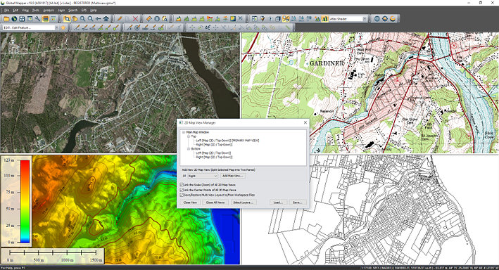
description (eng) Global Mapper is an affordable and easy-to-use GIS application that offers access to an unparalleled variety of spatial datasets and provides just the right level of functionality to satisfy both experienced GIS professionals and beginning users.
Global Mapper Overview
Equally well suited as a standalone spatial data management tool and as an integral component of an enterprise-wide GIS, Global Mapper is a must-have for anyone who works with maps or spatial data.
Low-cost and easy-to-use GIS
Supports over 250 spatial data formats
Optional LiDAR Module for powerful point cloud processing
Advanced projection management using GeoCalc library*
Unmatched and complimentary technical support
Global Mapper is more than just a utility; it offers a surprisingly extensive collection of analysis and data processing tools in a truly affordable package. Providing support for virtually every known spatial file format as well as direct access to common spatial databases, this remarkable application can read, write, and analyze all of your current data.
Global Mapper's intuitive user interface and logical layout helps smooth the learning curve and ensures that users will be up-and-running in no time. Your company will quickly see a significant return on investment brought about by efficient data processing, accurate map creation and optimized spatial data management.
Interface languages: En
OS: Windows 10/8/7 (32bit-64bit)
Homepage: bluemarblegeo.com
скачать бесплатно / free download Global Mapper Pro 25.1.1 + crack (License patched) ~ 475 Mb
x64
25.1.1 Build 030624_SoftoRooM.rar
Mirror / Зеркало
https://wdho.ru/bpgQ
Mirror / Зеркало
https://mega.nz/file/B...am3BCdrfHjFXVE
password softoroom
Mirror / Зеркало
https://wdho.ru/bpgQ
Mirror / Зеркало
https://mega.nz/file/B...am3BCdrfHjFXVE
password softoroom
ver. 22.1.1 - x32
https://www9.zippyshar...5dxZ/file.html
Mirror / Зеркало
https://wdho.ru/faf82
Mirror / Зеркало
https://mega.nz/file/C...D9UlfzukGNclPA
password softoroom
Mirror / Зеркало
https://wdho.ru/faf82
Mirror / Зеркало
https://mega.nz/file/C...D9UlfzukGNclPA
password softoroom
de1ay, 16.02.2006 - 8:31
Global Mapper v7.03Download/Скачать:
http://www.enfull.com...=789&soft=down
Crack:
de1ay, 8.05.2006 - 7:09
Global Mapper v7.04
Link(~17,2mb):
http://www.globalmapp...per7_setup.exe
 Serial:
Пробуем из предыдущего поста... У меня идентифицируется как троян
alt-sasha, 29.09.2007 - 22:21
Global Mapper crackРазмер: 25 Мб
Evotech, 29.01.2009 - 23:51
Global Mapper v10.02Среди наиболее важных новшеств можно отметить следующее:
* Улучшенная поддержка импорта баз данных ESRI MDB, а также импорта/экспорта файлов BigTIFF
* Более совершенная система вставки подписей точечных объектов с более гибкими возможностями для выбора типа и кегля шрифтов. Автоматически предлагаются различные варианты размещения подписей.
* Поддержка выбора или изменения слоя, в котором расположен объект при его редактировании или при создании новых объектов с помощью инструмента оцифровки Digitizer Tool.
* Модуль Super Overlay Support для форматов KML и KMZ. Он позволяет работать с большими объемами данных в среде Google Earth.
* Дополнительные средства прописки координат новым объектам на основе расстояний и азимутов, либо на базе алгоритмов COGO с использованием инструмента Digitizer Tool.
* Новые опции редактирования наборов объектов с изменением их атрибутов и копирования значений какого-либо атрибута в значения другого атрибута.
* В меню Tools включен новый модуль Coordinate Convertor для преобразования систем координат из одной проекции в другую с учетом систем исходных дат и единиц измерения.
* Усовершенствован диалог Search Vector Data для выполнения запросов на поиск нужных векторных данных.
* Расширена палитра выбора стилей линий.
* Более гибкая система вставки растровых данных в выбранную область.
* Улучшена поддержка экспорта векторных данных в формате MapInfo TAB/MAP, а также экспорта линейных и точечных объектов в формате SEGP1.
Размер: 26.89 MB
Лекарство в архиве
Vselennaya, 5.01.2010 - 15:18
Global Mapper 11.01
Интерфейс: Английский
ОС: Windows All
 Download: ~ 43.89 MB
PRYANIK, 26.09.2017 - 22:01
Global Mapper 19 + crack (cracked)
Цитата | Quote(Global Mapper)
New in v19
Significant New Features
New Attribute Editor, replacing the old vector search function. In addition to querying, this tool now allows for spreadsheet-style editing of feature attributes in a dockable window
Improved hillshade rendering with an interactive tool for dynamically positioning the light source using real time click and drag control
Drag and drop docking for 3D, Path Profile and Attribute Editor windows
Many new online data sources for the U.S. and Canada including many individual states and provinces
New option to limit the extent of terrain data displayed in the 3D Viewer based on the geographic extent of the 2D map
Several new built-in raster calculation functions including Normalized Difference Snow Index (NDSI) and Advanced Vegetation Index (AVI)
Scripting Changes
Script commands that take a source FILENAME now support multiple FILENAME parameters for the command to match multiple filename masks
Improved handling of local files when loading a moved workspace. Local files at or under the workspace folder will be preferred to explicit file paths in the original workspace folder
Redesigned Scripting Reference Guide offering easy access to script parameters
b092417
x32+x64
hack BEAN
https://yadi.sk/d/3n17-udk3NFBWG
Mirror / Зеркало
https://mega.nz/gomeganz...8Dmxqb7wznVioA
password softoroom
Mirror / Зеркало
https://mega.nz/gomeganz...8Dmxqb7wznVioA
password softoroom
PRYANIK, 21.09.2018 - 7:25
Global Mapper 20 + crack (License)
Цитата | Quote
New in v20
Significant New Features
A new tool for creating a 3D point cloud from a mesh or 3D model
A new free flight mode for navigating in 3D
Eyedropper tool for selecting a color directly from a raster image in the map view
Dramatic speed improvements for the load time of many vector formats such as shapefiles
Expanded support for Windows Tablet and touch screen computers
New Map Layout options including legend filtering and creating a map book from selected features
Improvements to Vector display in 3D including smoothness of movement on large datasets
Streamlined licensing process
hack в комплекте
x86
https://www.upload.ee/...6_fu11.7z.html
Mirror / Зеркало
https://yadi.sk/d/R3Xoa-uP8HvAtg
Mirror / Зеркало
https://mega.nz/gomeganz...8zhzYRNubf89m4
password softoroom
Mirror / Зеркало
https://yadi.sk/d/R3Xoa-uP8HvAtg
Mirror / Зеркало
https://mega.nz/gomeganz...8zhzYRNubf89m4
password softoroom
x64
https://files.fm/down.....0.x64_fu11.7z
Mirror / Зеркало
https://yadi.sk/d/2XGU46WCViWB8Q
Mirror / Зеркало
https://mega.nz/gomeganz...OjslQRPvi4RdpY
password softoroom
Mirror / Зеркало
https://yadi.sk/d/2XGU46WCViWB8Q
Mirror / Зеркало
https://mega.nz/gomeganz...OjslQRPvi4RdpY
password softoroom
PRYANIK, 10.11.2018 - 11:01
Global Mapper 20.1 + crack (License-patch)
hack в комплекте
x64
https://www.upload.ee/...11.7z.001.html
https://www.upload.ee/...11.7z.002.html
Mirror / Зеркало
https://wdho.ru/8T0
https://wdho.ru/8T1
Mirror / Зеркало
https://yadi.sk/d/eTfsjd_cPUpwow
https://yadi.sk/d/ddCR5ZKGbB8GNQ
password softoroom
https://www.upload.ee/...11.7z.002.html
Mirror / Зеркало
https://wdho.ru/8T0
https://wdho.ru/8T1
Mirror / Зеркало
https://yadi.sk/d/eTfsjd_cPUpwow
https://yadi.sk/d/ddCR5ZKGbB8GNQ
password softoroom
PRYANIK, 17.01.2020 - 11:44
Global Mapper 21 + crack (LIC patched)
x64
https://www.upload.ee/...11.7z.001.html
https://www.upload.ee/...11.7z.002.html
Mirror / Зеркало
https://wdho.ru/hBdO
https://wdho.ru/hBdP
Mirror / Зеркало
https://mega.nz/gomeganz...XHCefUNNnznAI0
https://mega.nz/gomeganz...bv_eou5vwpM9wY
password softoroom
https://www.upload.ee/...11.7z.002.html
Mirror / Зеркало
https://wdho.ru/hBdO
https://wdho.ru/hBdP
Mirror / Зеркало
https://mega.nz/gomeganz...XHCefUNNnznAI0
https://mega.nz/gomeganz...bv_eou5vwpM9wY
password softoroom
PRYANIK, 14.02.2020 - 11:37
Global Mapper 21.0.1 + crack (key patched)
Build 100319
x64
https://www.upload.ee/...part1.rar.html
https://www.upload.ee/...part2.rar.html
Mirror / Зеркало
https://wdho.ru/55nh
https://wdho.ru/55ng
Mirror / Зеркало
https://mega.nz/gomeganz...Ma0vwkFJGz2hUc
https://mega.nz/gomeganz...VBgKlBm7LG3eIk
password softoroom
https://www.upload.ee/...part2.rar.html
Mirror / Зеркало
https://wdho.ru/55nh
https://wdho.ru/55ng
Mirror / Зеркало
https://mega.nz/gomeganz...Ma0vwkFJGz2hUc
https://mega.nz/gomeganz...VBgKlBm7LG3eIk
password softoroom
PRYANIK, 8.06.2020 - 9:53
Global Mapper 21.1 + crack (license patched)
Цитата | Quote(changelog Global Mapper 21.1)
Improved raster transparency tool with a new option to select multiple colors to be transparent
New Raster Reclassification analysis tool, that allows users to reassign pixel palette index values and can be used to replace values, group values together, and reclassify values to a common scale
Built-in access to premium online Blackbeard Data Services premium online oil and gas data, providing pipeline, well, and lease information
New cloud import and export functionality for accessing public Amazon Web Service (AWS) buckets, such as USGS Lidar data
New Digitizer tool for setting the slope between individual vertices in a line feature
Expanded vector feature shift functionality to include the option to apply a vertical offset
New styling options for selected lidar points in the 3D View allowing both attribute coloring and selection state to be displayed
Significant speed improvements to viewshed calculation, especially on computers with a large number of cores
Improved rendering speed when working with large raster/terrain layers on multi-core computers
Reduction in the processing time when using the Batch Conversion/Reproject tool
New tool for saving user settings, allowing user-interface customization and styles to be shared between computers
New option to save and reload queries in the attribute search dialog box
x86
https://www.upload.ee/...part1.rar.html
https://www.upload.ee/...part2.rar.html
Mirror / Зеркало
https://wdho.ru/5k5i
https://wdho.ru/5k5h
Mirror / Зеркало
https://mega.nz/file/r...Yac9hlVcAO5PNI
https://mega.nz/file/K...3l4R3wn_I85dp0
password softoroom
https://www.upload.ee/...part2.rar.html
Mirror / Зеркало
https://wdho.ru/5k5i
https://wdho.ru/5k5h
Mirror / Зеркало
https://mega.nz/file/r...Yac9hlVcAO5PNI
https://mega.nz/file/K...3l4R3wn_I85dp0
password softoroom
x64
https://www.upload.ee/...part1.rar.html
https://www.upload.ee/...part2.rar.html
Mirror / Зеркало
https://wdho.ru/5k5g
https://wdho.ru/5k5f
Mirror / Зеркало
https://mega.nz/file/T...8ZrrgeK3DYsqcw
https://mega.nz/file/q...4iWL_8pOIbi4jo
password softoroom
https://www.upload.ee/...part2.rar.html
Mirror / Зеркало
https://wdho.ru/5k5g
https://wdho.ru/5k5f
Mirror / Зеркало
https://mega.nz/file/T...8ZrrgeK3DYsqcw
https://mega.nz/file/q...4iWL_8pOIbi4jo
password softoroom
PRYANIK, 20.09.2020 - 19:53
Global Mapper 22 + crack (patched)
New Eye Dome Lighting settings in the 3D viewer to help improve the visual display of vector and lidar data
A new tool for simplifying loaded meshes or TINs
A new Spatial Operations tool to find the intersection of two vector layers
A new Analysis menu option to find the overlap (both percentage and graphical) between two or more lidar, raster/image, and/or terrain layers.
An update to the Raster Reclassify tool that allows it to work with continuous data (terrain / slope, single bands of imagery).
A new sweep selection tool for working with vector data in the 3D viewer
Dramatically faster rendering of tiled online sources, especially in 3D.
Support for creating point, line, or area features from a list of coordinates in an MS Excel (.xls/.xlsx) file.
A new Digitizer menu providing convenient access to all Digitizer functions.
A tabular preview showing the first ten lines of an imported ASCII or Excel file.
x32
https://www.upload.ee/...part1.rar.html
https://www.upload.ee/...part2.rar.html
Mirror / Зеркало
https://wdho.ru/5z58
https://wdho.ru/5z57
Mirror / Зеркало
https://mega.nz/file/c...HE7Vw7tkCtCRgY
https://mega.nz/file/w...5VvuuMhc2Z-Lec
password softoroom
https://www.upload.ee/...part2.rar.html
Mirror / Зеркало
https://wdho.ru/5z58
https://wdho.ru/5z57
Mirror / Зеркало
https://mega.nz/file/c...HE7Vw7tkCtCRgY
https://mega.nz/file/w...5VvuuMhc2Z-Lec
password softoroom
x64
https://www.upload.ee/...part1.rar.html
https://www.upload.ee/...part2.rar.html
Mirror / Зеркало
https://wdho.ru/5z56
https://wdho.ru/5z55
Mirror / Зеркало
https://mega.nz/file/0...123fW5y-zXXxTU
https://mega.nz/file/s..._uSXYDJzeqbJso
password softoroom
https://www.upload.ee/...part2.rar.html
Mirror / Зеркало
https://wdho.ru/5z56
https://wdho.ru/5z55
Mirror / Зеркало
https://mega.nz/file/0...123fW5y-zXXxTU
https://mega.nz/file/s..._uSXYDJzeqbJso
password softoroom
PRYANIK, 18.10.2020 - 11:38
Global Mapper 22.0.1 + crack (patched)
Build 101520
x32
https://www.upload.ee/...part1.rar.html
https://www.upload.ee/...part2.rar.html
Mirror / Зеркало
https://wdho.ru/if2o
https://wdho.ru/if2p
Mirror / Зеркало
https://yadi.sk/d/Ev0vMvEv6A8rZg
https://mega.nz/file/M...9NEbg-bDdRhuxw
password softoroom
https://www.upload.ee/...part2.rar.html
Mirror / Зеркало
https://wdho.ru/if2o
https://wdho.ru/if2p
Mirror / Зеркало
https://yadi.sk/d/Ev0vMvEv6A8rZg
https://mega.nz/file/M...9NEbg-bDdRhuxw
password softoroom
x64
https://www.upload.ee/...part1.rar.html
https://www.upload.ee/...part2.rar.html
Mirror / Зеркало
https://wdho.ru/if2r
https://wdho.ru/if2s
Mirror / Зеркало
https://mega.nz/file/g...pxyo6YD6iTfcCQ
https://mega.nz/file/l...F6EqN81B8PrOfc
password softoroom
https://www.upload.ee/...part2.rar.html
Mirror / Зеркало
https://wdho.ru/if2r
https://wdho.ru/if2s
Mirror / Зеркало
https://mega.nz/file/g...pxyo6YD6iTfcCQ
https://mega.nz/file/l...F6EqN81B8PrOfc
password softoroom
PRYANIK, 20.10.2020 - 11:13
Global Mapper 22.0.1 + crack (license patched)
Build 101920
x32
https://www.upload.ee/...part1.rar.html
https://www.upload.ee/...part2.rar.html
Mirror / Зеркало
https://wdho.ru/e3dn
https://wdho.ru/e3do
Mirror / Зеркало
https://mega.nz/file/c...kUgcJbpKgNRqRQ
https://mega.nz/file/J...w0yTO_BE4Hm-xQ
password softoroom
https://www.upload.ee/...part2.rar.html
Mirror / Зеркало
https://wdho.ru/e3dn
https://wdho.ru/e3do
Mirror / Зеркало
https://mega.nz/file/c...kUgcJbpKgNRqRQ
https://mega.nz/file/J...w0yTO_BE4Hm-xQ
password softoroom
x64
https://www.upload.ee/...part1.rar.html
https://www.upload.ee/...part2.rar.html
Mirror / Зеркало
https://wdho.ru/e3dq
https://wdho.ru/e3dr
Mirror / Зеркало
https://mega.nz/file/8...wUafUoqTtFpJeA
https://mega.nz/file/E...71mn4-3_K3d9OE
password softoroom
https://www.upload.ee/...part2.rar.html
Mirror / Зеркало
https://wdho.ru/e3dq
https://wdho.ru/e3dr
Mirror / Зеркало
https://mega.nz/file/8...wUafUoqTtFpJeA
https://mega.nz/file/E...71mn4-3_K3d9OE
password softoroom
PRYANIK, 18.02.2021 - 10:54
Global Mapper 22.1 + crack (patched)
x32
https://www.upload.ee/...part1.rar.html
https://www.upload.ee/...part2.rar.html
Mirror / Зеркало
https://wdho.ru/8bf177
https://wdho.ru/4edb31
Mirror / Зеркало
https://mega.nz/file/0...5Dul6L2V75PWr8
https://mega.nz/file/Y...TGMySFUuRg0O4Q
password softoroom
https://www.upload.ee/...part2.rar.html
Mirror / Зеркало
https://wdho.ru/8bf177
https://wdho.ru/4edb31
Mirror / Зеркало
https://mega.nz/file/0...5Dul6L2V75PWr8
https://mega.nz/file/Y...TGMySFUuRg0O4Q
password softoroom
x64
https://www.upload.ee/...part1.rar.html
https://www.upload.ee/...part2.rar.html
Mirror / Зеркало
https://wdho.ru/610fe2
https://wdho.ru/4bce3a
Mirror / Зеркало
https://mega.nz/file/t...1cT3A2gsn9V0x8
https://mega.nz/file/l...23H30Rzw8N4y1s
password softoroom
https://www.upload.ee/...part2.rar.html
Mirror / Зеркало
https://wdho.ru/610fe2
https://wdho.ru/4bce3a
Mirror / Зеркало
https://mega.nz/file/t...1cT3A2gsn9V0x8
https://mega.nz/file/l...23H30Rzw8N4y1s
password softoroom
PRYANIK, 10.03.2021 - 21:10
Global Mapper 22.1.1 + crack (patched)
x32
https://www9.zippyshar...5dxZ/file.html
Mirror / Зеркало
https://wdho.ru/faf82
Mirror / Зеркало
https://mega.nz/file/C...D9UlfzukGNclPA
password softoroom
Mirror / Зеркало
https://wdho.ru/faf82
Mirror / Зеркало
https://mega.nz/file/C...D9UlfzukGNclPA
password softoroom
x64
https://www9.zippyshar...MqgD/file.html
Mirror / Зеркало
https://wdho.ru/1cb9f
Mirror / Зеркало
https://mega.nz/file/H...Z8V882tgM4jeLg
password softoroom
Mirror / Зеркало
https://wdho.ru/1cb9f
Mirror / Зеркало
https://mega.nz/file/H...Z8V882tgM4jeLg
password softoroom
PRYANIK, 17.09.2021 - 12:30
Global Mapper Pro 23.0 + crack (key patched)
Build 091421
x64
https://www.upload.ee/...part1.rar.html
https://www.upload.ee/...part2.rar.html
Mirror / Зеркало
https://wdho.ru/76d401
https://wdho.ru/e2273c
Mirror / Зеркало
https://mega.nz/file/o...CMLrpbQ1GTbnTY
https://mega.nz/file/A...f6kj7F9EndPJyI
password softoroom
https://www.upload.ee/...part2.rar.html
Mirror / Зеркало
https://wdho.ru/76d401
https://wdho.ru/e2273c
Mirror / Зеркало
https://mega.nz/file/o...CMLrpbQ1GTbnTY
https://mega.nz/file/A...f6kj7F9EndPJyI
password softoroom
PRYANIK, 17.02.2022 - 20:03
Global Mapper 23.1.0 + crack (patched)
Build 021522
PRYANIK, 21.09.2022 - 13:55
Global Mapper 24.0 + crack (patched)
Build 092022
https://www.upload.ee/...part1.rar.html
https://www.upload.ee/...part2.rar.html
Mirror / Зеркало
https://wdho.ru/e84368
https://wdho.ru/6c204a
Mirror / Зеркало
https://mega.nz/file/1...fZ9pc2JyOALZ3c
https://mega.nz/file/Z...Upk9IFeD4UCnSs
password softoroom
https://www.upload.ee/...part2.rar.html
Mirror / Зеркало
https://wdho.ru/e84368
https://wdho.ru/6c204a
Mirror / Зеркало
https://mega.nz/file/1...fZ9pc2JyOALZ3c
https://mega.nz/file/Z...Upk9IFeD4UCnSs
password softoroom
PRYANIK, 20.10.2022 - 18:15
ver. 24.0 Build 101822 + crack (patched)
https://krakenfiles.co...Xa8R/file.html
Mirror / Зеркало
https://wdho.ru/e3f21e
Mirror / Зеркало
https://mega.nz/file/n...wdW8yakslRHGM4
password softoroom
Mirror / Зеркало
https://wdho.ru/e3f21e
Mirror / Зеркало
https://mega.nz/file/n...wdW8yakslRHGM4
password softoroom
PRYANIK, 16.02.2023 - 9:47
ver. 24.1 Build 021423 + crack (patch)
https://krakenfiles.co...2eY4/file.html
Mirror / Зеркало
https://wdho.ru/d902f7
Mirror / Зеркало
https://mega.nz/file/3...fblop8JGh0kiY0
password softoroom
Mirror / Зеркало
https://wdho.ru/d902f7
Mirror / Зеркало
https://mega.nz/file/3...fblop8JGh0kiY0
password softoroom
PRYANIK, 9.03.2023 - 10:35
ver. 24.1 Build 022723
https://krakenfiles.co...AmXp/file.html
Mirror / Зеркало
https://wdho.ru/d69e11
Mirror / Зеркало
https://mega.nz/file/j...0yceL--PKGEGwY
password softoroom
Mirror / Зеркало
https://wdho.ru/d69e11
Mirror / Зеркало
https://mega.nz/file/j...0yceL--PKGEGwY
password softoroom
PRYANIK, 27.09.2023 - 9:28
version 25.0 Build 092623
https://wdho.ru/fi6o
Mirror / Зеркало
https://disk.yandex.ru...GQHs7Z2MvXHDCg
Mirror / Зеркало
https://mega.nz/file/Z...QLpp6YYjYfbDbs
password softoroom
Mirror / Зеркало
https://disk.yandex.ru...GQHs7Z2MvXHDCg
Mirror / Зеркало
https://mega.nz/file/Z...QLpp6YYjYfbDbs
password softoroom
PRYANIK, 8.11.2023 - 16:46
version Pro 25.0.1 b102323
25.0.1 b102323_SoftoRooM.rar
Mirror / Зеркало
https://wdho.ru/bbiV
Mirror / Зеркало
https://mega.nz/file/b...NC8ETUFfis7e8k
password softoroom
Mirror / Зеркало
https://wdho.ru/bbiV
Mirror / Зеркало
https://mega.nz/file/b...NC8ETUFfis7e8k
password softoroom
PRYANIK, 16.11.2023 - 11:50
version Pro 25.0.2
Build 111523
25.0.2 b111523_SoftoRooM.rar
Mirror / Зеркало
https://wdho.ru/foRT
Mirror / Зеркало
https://mega.nz/file/U...yGmbDpFMH0zL4Y
password softoroom
Mirror / Зеркало
https://wdho.ru/foRT
Mirror / Зеркало
https://mega.nz/file/U...yGmbDpFMH0zL4Y
password softoroom
PRYANIK, 15.02.2024 - 13:07
version Pro 25.1.0 + crack (patch)
25.1 includes exciting new tools and increased functionality. Among other Pixels to Points updates, Ground Control Points can now be automatically identified and placed in imagery. Improvements have also been added to the award-winning Custom Classification Training tool. Subclassifications can now be created when classifying point clouds, adding detail to point cloud visualization without sacrificing functionality or processing.
Pro 25.1.0_b021424 SoftoRooM.rar
Mirror / Зеркало
https://wdho.ru/fyNP
Mirror / Зеркало
https://mega.nz/file/s...ZLinIrYo7w81Ew
password softoroom
Mirror / Зеркало
https://wdho.ru/fyNP
Mirror / Зеркало
https://mega.nz/file/s...ZLinIrYo7w81Ew
password softoroom
PRYANIK, 7.03.2024 - 11:17
version 25.1.1 Build 030624
25.1.1 Build 030624_SoftoRooM.rar
Mirror / Зеркало
https://wdho.ru/bpgQ
Mirror / Зеркало
https://mega.nz/file/B...am3BCdrfHjFXVE
password softoroom
Mirror / Зеркало
https://wdho.ru/bpgQ
Mirror / Зеркало
https://mega.nz/file/B...am3BCdrfHjFXVE
password softoroom